Our booklet of circular walks from Draughton was first compiled in 2009 during the process of preparing our Parish Plan. We owe our thanks to Douglas Goode for both the idea and the work involved in initially producing the booklet. See the original version at the bottom of this page.
Partly in response to the coronavirus outbreak and lockdown in Spring 2020, to help local people access walks from their homes, the publication was updated and substantially revised to include more detailed instructions and additional routes. Thanks to Chris Walker for producing the revised version for us on behalf of the Parish Council.

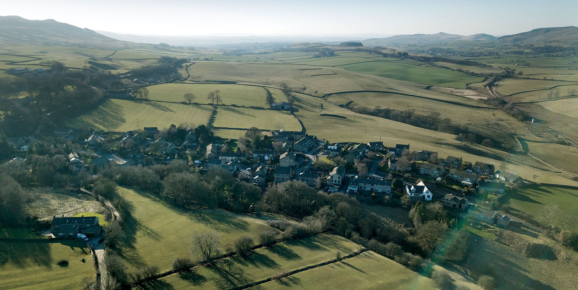
© OpenStreetMap contributors (https://www.openstreetmap.org/copyright)
Walk 1: Draughton – Eastby – Halton East – Draughton
Distance: 4.4km (2.2 miles)
Time: 1 hour 20 mins approx.
This walk includes a short stretch of road walking along the A59 between Skibeden and Holywell Railway Bridge. Only use this route if you are confident that you can do so safely.
Head north down the village and turn left immediately after Draughton Hall to a farm gate (there is a stile over the wall to the right). Once past the gate follow the sheep shelter wall then bear slightly to the right (NNW) down to a stone slab bridge over the small stream. Continue along the field, keeping the field wall to your left. Go over the wall stile and walk across the pasture, keeping the disused railway bridge across the valley to your right-hand side, to a further wall stile. Use this with care as it may be very muddy after rain, especially on the far side. Then cross the field diagonally (NNW) heading for a group of trees that should be slightly to your left. There is a stile here, leading on to the A59 Skipton – Harrogate Road (1M, GR 026 532).
Turn right along the road, taking great care, downhill to Holywell Railway Bridge. Note that there is no verge on the bridge itself. Once over the bridge turn right immediately and cross a stone wall stile. From the stile, head due east over fields and two more wall stiles to reach Thorn Haws Laithe (GR 039 533), then use the gates to reach the A59 again.
Cross the road with care, then turn left along the wide verge as far as the top of the hill and the junction with the lane leading to Halton East. Turn onto the lane and after five metres find a waymarked stile on your right. Once over this stile, follow the narrow grassy path through pleasant woodland, more or less parallel with the main road, keeping Lumb Gill beck to your left, until you reach a wooden stile at the foot of the hill leading on to the main road again at its junction with the lane back to Draughton (GR 043 533). Re-cross the main road, then walk back along the lane past Draughton Bottom and up the hill until you arrive back at your starting point.


Walk 2: Draughton – Eastby – Halton East – Draughton
Distance: 8km (5 miles)
Time: 2 hour 30 mins approx.
Head north down the village and turn left immediately after Draughton Hall to a farm gate (there is a stile over the wall to the right). Once past the gate follow the sheep shelter wall then bear slightly to the right (NNW) down to a stone slab bridge over the small stream. Keeping the field wall to your left, cross the wall stile and over the pasture, with the disused railway bridge across the valley to your right-hand side, to a further wall stile. Go over this carefully as it may be very muddy after rain, especially on the far side. Then cross the field diagonally (NNW) heading for a group of trees that should be slightly to your left. There is a stile here, leading on to the A59 Skipton to Harrogate road (1 M, GR 026 532).
Cross the road with care to the stone stile opposite. Once over the stile, use the wooden telegraph pole as a marker to cross the field, then descend to the metal pedestrian footbridge over the railway line (wooden stiles at each end). Cross the bridge and continue down the side of the field, keeping the railway to your left, to a third wooden stile. A small stream has to be crossed immediately before the stile, and it can be very boggy on either side. Once across this stile, walk diagonally over the field to a culvert outflow and through the metal gate in the fence, bearing left slightly as you go. You will reach a stone stile to the right of Water Lane Laithe (GR 022 536). Climb over this stile on to the Embsay – Halton East road. Immediately across the road is the entrance of the track (bridleway) to Eastby. Follow this all the way, keeping right at the junction of the farm lanes, to reach the village at Bower House Farm (GR 019 544).
Turn right onto the road and walk to the end of the village then bear right along Bark Lane (track) (marked “No access to Studfold Farm”). Where the track ends (1 km from the village) there is a wall stile immediately to your right. Use the stile, then go diagonally SE across the field to pass through a squeeze stile and over the stone bridge across the beck. Now continue ESE, keeping the beck to your left throughout, so as to cross a farm track then three stone stiles. On reaching the large field beyond these stiles, continue to keep the beck to your left until you reach a metal farm gate. Pass through the gate, through the field to a second farm gate, then walk on, keeping the fence of a small paddock to your immediate right. This brings you to a third set of gates (usually open) and the paved access road of Calm Slate Farm (whose buildings should be on your right).
Now turn left along the farm access road until it joins the public road, using the gate to the immediate right of the cattle grid (Moor Lane, which becomes a rough track at this point). Turn right along the paved surface and continue south until you reach the small village green (seating available here) then left past the disused bus shelter into Halton East village. After 60 m (GR 042 539) turn right along the short ginnel between buildings, then along a short lane with metal gates at either end, keeping a cowshed and its concrete apron over the wall to your left. From here, simply head south downhill across stone and wooden field stiles and through the small plantation to reach the A59 (GR 043 533). Cross this, (now three lane) road with care and walk back towards Draughton along Low Lane via Priors Bridge and Draughton Bottom until you reach your starting point.
Possible Extensions
Stout boots, clothing and suitable equipment are strongly advised for both extensions. Access to both of them may be restricted occasionally during the grouse shooting season.
Embsay Crag and beyond …
You could extend the walk to a total of 16.5 km (10.3 miles, five and a half hours) by turning left at the junction of farm lanes immediately before reaching Bower House Farm at Eastby, passing through Embsay in order to climb Embsay Crag. You might then continue along the wall side of this open access area as far as a cattle grid on the Eastby to Barden road, and making your way from there on to Moor Lane in order to return to the original route immediately before Halton East.
Eastby Gate and Hutchen Gill
A slightly shorter route follows the walk to Bower House Farm at Eastby, but then turns left (instead of right) when reaching the road. Then, after about 60 m, turn right at the waymark outside Hunter’s Laithe house, up Hunters Croft and along the path that runs past the left side of Number 2’s garden wall. Cross over a wooden stile. You now ascend the wooded Heugh Gill to Eastby Gate, from where you continue straight across the moor along a barely visible path, passing grouse butts, to the shooting hut near the top of Hutchen Gill. Here, turn right to descend the gill (track) to reach the Bolton Abbey to Rylstone bridleway (from which are excellent views up and down Wharfedale and across to Simon’s Seat). A right turn here will bring you back to the Eastby – Barden road at the cattle grid south of Lower Barden Reservoir. The top of Moor Lane (here just a track) is directly across the road, and this will take you back down to Halton East to rejoin the original walk.
“Billy Bob’s” is at Calm Slate Farm, on the approach to Halton East (American diner style menu and ice cream parlour). Opening hours:
February – October
Daily: 9:00 am to 5:45 pm
October – February
Monday – Thursday 9:45 am to 4:45 pm
Friday – Sunday 9:00 am to 5:45 pm


Walk 3: Draughton – Berwick East – Draughton
Distance: 5.5km (3.4 miles)
Time: 1 hour 40 mins approx.
This route returns to Draughton via a one kilometre walk along the busy A65 Leeds to Skipton road. Please avoid the latter part of the route unless you are absolutely confident of your ability to walk along it safely. Alternative ways back are suggested below.
Walk east along Church Lane between the Village Hall (left) and the Church (right). Bear right immediately after the first cattle grid and continue past another cattle grid until the lane turns right at ninety degrees (Haynholme). Here you must continue straight ahead through the wooden field gate and follow the wall downhill to a metal gate followed immediately by a stone slab bridge over a beck. Cross this and climb the other side of the hill keeping the fencing to your right and continue roughly ENE to a further field gate. Once through this, continue across the fields keeping the wall to your right until reaching another field gate by a small stream (it may be muddy here).
After passing through this gate, turn slightly to the right to go uphill, diagonally across the field to a wooden stile over a fence (GR 0605 5254). Once over the stile, turn approximately SW and continue uphill to another metal field gate. After passing through, roughly follow the contour of the side of Haw Pike (it is possible to climb from here to the trig point at the summit of Haw Pike, giving excellent all-round views, but there is no formal right of way to the top).
To reach Berwick East Farm, you will find a stone stile in the wall in the right-hand corner of the field. Cross this and proceed through a small group of trees and a wooden gate through a fence to pass around the front of the farm buildings. If you want to avoid walking along the A65, this is the point at which you should start using one of the alternatives set out below. Turn right at the end of the farmhouse, to find the next stone stile almost immediately to the left, opposite the SW wall of the building. Note that the public right of way around Berwick East Farm may be subject to change.
Use this stile, then keep the stone wall to your right as you descend the field towards Berwick West Farm. At Berwick West, turn left along the farm road for 50 m then turn right (SW), walking diagonally across a field to a stream and gate, from where you climb uphill to reach the main A65 road close to the old milepost at the start of the Chelker bends.
Turn right along the A65, keeping as close to the right-hand side of the road as possible so as to face oncoming traffic, using the narrow verge wherever you can. After a 1 km walk along the main road, turn right towards Draughton, then right again when you come to the stone stile immediately before the bridge over Howgill Beck. Follow the footpath across the fields, keeping the beck and old quarry to your left, eventually to emerge on to Church Lane. Turn left to return to the start.
Alternative routes avoiding the A65
A: via Hag Head Laithe and Hawpike Farm
From the far corner of Berwick East Farm, turn left along the access road until you reach the edge of the small copse to the left. Turn left here, walk upwards through the copse, and cross the wooden stile at the top. Continue straight uphill to the stone stile. After crossing this, follow the wall to your left until you reach the corner of the field. You will see a stile in the wall to your left. Climb it, then turn round completely until you are facing it. You will see that there is a metal gate almost immediately to the left of the stile you have just crossed. Go through this gate and turn left, keeping the wall to your left.
When you reach the two closely-spaced metal gates, go through both into the next field. Cross it until you come to the hole in the wall with weathered gateposts. Once through the hole, bear left across the field towards the small stone building (waterworks), heading for the wall stile to the left of the fence around the building. After crossing the stile, bear left towards the small group of trees that mark the edge of the rubble ruins of Hag Head Laithe (GR 0651 5161).
Leaving the ruins on your left, continue along the track using the stiles or gates. As you approach Hawpike Farm you will see the end of a large shed immediately ahead. Take the field gate to the left of the shed and walk roughly NW across the field until you reach the wooden stile across the fence (GR 0605 5254). Now retrace your steps back to Draughton.
B: via the Roman Road and Draughton Height (You will also need the sheet for Walk 6 for this) or to return by bus from the A65
From the far corner of Berwick East Farm, turn left along the access road until you reach the edge of the small copse to the left. Turn left here, walk upwards through the copse, and cross the wooden stile at the top. Continue straight uphill to the stone stile. After crossing this, follow the wall to your left until you reach the corner of the field. You will see a stile in the wall to your left. Climb it, then turn round completely until you are facing it. You will see that there is a metal gate almost immediately to the left of the stile you have just crossed. Go through this gate and turn left, keeping the wall to your left.
When you reach the two closely-spaced metal gates, go through both into the next field. Cross it until you come to the hole in the wall with weathered gateposts. Once through the hole, bear left across the field towards the small stone building (waterworks), heading for the wall stile to the left of the fence around the building. On the other side of this stile you should keep straight ahead to the stile in the wall opposite, across the field. Over this stile, keep the wall to your right as you continue ahead (roughly S) to reach the side of Highfield Farm.
At Highfield Farm cross the wall stile to the left (E) of the buildings and walk across the field either to the gate or the wall stile to its right (you may use either) leading in to the grounds of Bracken Ghyll Golf Club. Once inside the grounds, turn right and walk diagonally downhill across the course, avoiding the greens and taking care when crossing fairways. The path leaves the Golf Course through a deciduous plantation and emerges shortly afterwards at a lay- by on the A65. Cross the road to the stop opposite if you elect to return to Draughton on the bus.
If returning to Draughton via the Roman Road and Draughton Height you should now refer to Sheet 6. Note that this roughly doubles the length of your walk.
There are bus stops in both directions at the lay-by on the A65. The X84 Leeds – Skipton service runs more or less hourly during the day, Monday to Saturday. There is no late evening service, and no service at all on Sundays and Bank Holiday Mondays. The journey time to Draughton from the bus stop opposite the lay-by is just 3-4 minutes. As these stops are little used, bus drivers are unlikely to expect to have to pick up passengers on this fast stretch of road. Indicate clearly and as soon as you see the bus appear if you want to board. Timetable information can be obtained from www.wymetro.com/buses/bus-timetables.
Note: May be restricted due to COVID-19


Walk 4: Draughton – Hawpike Farm – Berwick East – Draughton
Distance: 7.2km (4.5 miles)
Time: 2 hour 15 mins approx.
Walk East along Church Lane between the Village Hall (left) and the Church (right). Bear right immediately after the first cattle grid and continue past another cattle grid until the lane turns right at ninety degrees (Haynholme). Here you must continue straight ahead through the wooden farm gate and follow the wall downhill to a metal field gate followed immediately by a stone slab bridge over a beck. Cross this and climb the other side of the hill keeping the fencing to your right and continue roughly ENE to a further field gate. Once through this, continue across the fields keeping the wall to your right until reaching another field gate by a small stream (it may be muddy here).
After passing through this gate, turn slightly to the right to go uphill, diagonally across the field to a wooden stile over a fence (GR 0605 5254). Now turn SE across the field, roughly following the contour and down to the side of Hawpike Farm farm-yard. With the shed to your left, use the gate at the end of the field to reach a farm track. Turn right (S) and uphill along this track, through gates and a stile by a gate (usually locked) for 1 kilometre to reach the remains of Hag Head Laithe (GR 0651 5161), which are on the right, just next to the track.
The line of the footpath around the side of Haw Pike is confusing, with a plethora of stiles and gates that appear to lead nowhere. The following directions should get you where you need to go.
There is a line of four sycamore trees immediately beyond Hag Head Laithe. Bear right across the field from these trees and you will reach a line of three stiles above the gate of a small stone building (waterworks). It does not matter which one you choose the cross (the bottom one is probably easiest). Bear right again across this next field and you will eventually reach a hole in the wall between two weathered gateposts. Go through here.
Chelker Reservoir should now appear on your left. Continue ahead through two metal gates, closely-spaced, one after the other. The field wall should now be kept to your right. Follow the wall until you reach the metal gate in the far corner. Go through this, then turn immediately so that you are facing the direction of the way you came. Just to the right of the gate you should see a stone wall stile. Climb it and turn right along the edge of the field, keeping the wall to your right. Once you have crossed the next wall stile at the end of the field, go straight down the slope to the wooden stile and continue through the young deciduous copse beyond. You quickly reach the access lane for Berwick East. Turn right here and you will see Berwick East Farm directly ahead. Continue along the lane until you reach the corner of the farm building.
When you reach the corner of the farmhouse, turn right along the front of the building, pass through the wooden gate into the trees at the far end, and over the wall stile into the field beyond. From here, walk roughly along the contour line to the metal field gate. If you turn slightly to the left through the gate, you can walk diagonally down to the fence stile and return to Draughton the way you came.


Walk 5: Draughton – Bolton Bridge – Halton East – Draughton (plus shortcut)
Distance: 8.6km (5.4 miles)
Time: 2 hour 40 mins approx.
Begin by walking East along Church Lane between the Village Hall (left) and the Church (right). Bear right immediately after the first cattle grid and continue past another cattle grid until the lane turns right at ninety degrees (Haynholme). Here you must continue straight ahead through the wooden farm gate and follow the wall downhill to a metal field gate followed immediately by a stone slab bridge over a beck. Cross this and climb the other side of the hill keeping the fencing to your right and continue roughly ENE to a further field gate. Once through this, continue across the fields keeping the wall to your right until reaching another field gate by a small stream (it may be muddy here). Walk through the gate.
Walk straight across the pasture to the field gate on the far side. Pass through this gate and turn left, following the old grassy path steeply downhill, with the wall to your left. There are good views of Bolton Priory, Beamsley Beacon and Simon’s Seat from here. Follow the track down over the old railway bridge (GR 0654 5305) and continue down the slope to climb two stiles and reach the A59 Skipton to Harrogate Road. Cross the road with care and negotiate a further stone wall stile on the bank at the other side. Cross the field, and then the footbridge over Hambledon Beck. The field in which you now find yourself, which you must cross diagonally bearing right, may be waterlogged after wet weather. There are steps and a stone stile on the far side of the field. Climbing this brings you to the former main road, now a bridleway (GR 069 532). At 100 m AOD, this is the lowest point on the walk. Turn left here (or detour right for a short way for refreshment at the Abbey Tea Rooms or The Devonshire Arms).
500 m after turning left along the bridleway (GR 065 534) take the stile on the right and walk diagonally up the meadow towards the left-hand tree of a group of three. Cross the stone stile here and walk diagonally across the flat field towards the buildings of Hesketh House farm. Keeping the farm buildings to your immediate left, you must use the heavy double farm gate to reach the minor road on the other side. Go left here and follow the road past Hesketh Farm Park all the way on to the junction with the road into the eastern side of Halton East village (GR 0442 5145). Take care along the road from Hesketh House to Halton East because it is popular with cyclists as well as cars visiting the Farm Park and it is used by agricultural vehicles.
At this junction turn left (S) to reach the eastern end of the village. At 230 m AOD, this is the highest point of the walk. Two thirds of the way down the village street, turn left (GR 042 539) along the short ginnel between buildings, then along a short lane with metal gates at either end, keeping a cowshed and its concrete apron over the wall to your left. From here, simply head south downhill across stone and wooden field stiles and through the small plantation to reach the A59 (GR 043 533). Cross this, (now three lane) road with care and walk back towards Draughton along Low Lane via Priors Bridge and Draughton Bottom until you reach your starting point.
Shortcut avoiding A59
This walk can be shortened slightly (by about 0.3 km) by turning left immediately after crossing the old railway bridge (GR 0654 5305) as you descend the slope towards the A59. Having turned, walk down this agricultural track parallel with the former cutting on your left side. Turn right when the track enters the field, and make your way down to the old bridge across Hambledon Beck. Having crossed the bridge, turn right to follow the path along the beck side (but turn and follow the path to the left if you want to visit the heritage railway at Bolton Abbey Station – no refreshment facilities). If you turn right, the path takes you under the A59 road bridge, to reach the old line of the main road. Go more or less straight across this and go over the stile (GR 065 534) to resume using the rest of the route towards Hesketh House and on to Halton East.
The only refreshments to be found are at Bolton Bridge (unless you divert to “Billy Bob’s” while at Halton East). In Bolton Bridge:
“Abbey Tea Rooms” serves hot meals, snacks, cakes, tea, coffee etc…. inside, at outside tables at the back in good weather, and to take away. Dogs are very welcome (free treats usually available). Opening hours are: Daily 10:00 am to 4:00 pm, except on Christmas Day.
“The Devonshire Arms” offers a variety of bars and restaurants. Opening times vary, depending on the service. A dress code may apply in some areas.


Walk 6: Hawpike Farm – Roman Road – Draughton Height – Draughton
Distance: 9.7km (6 miles)
Time: 3 hour approx.
Going in the reverse direction, anticlockwise, gives better views on this walk, and may be easier to manage as the hardest work is then done at the start of the walk during the climb to Draughton Height.
Travelling clockwise, walk east along Church Lane between the Village Hall (left) and the Church (right). Bear right immediately after the first cattle grid and continue past another cattle grid until the lane turns right at ninety degrees (Haynholme). Here you must continue straight ahead through the wooden farm gate and follow the wall downhill to a metal field gate followed immediately by a stone slab bridge over a beck. Cross this and climb the other side of the hill keeping the fencing to your right and continue roughly ENE to a further field gate. Once through this, continue across the fields keeping the wall to your right until reaching another field gate by a small stream (it may be muddy here).
After passing through this gate, turn slightly to the right to go uphill, diagonally across the field to a wooden stile over a fence (GR 0605 5254). Now turn SE across the field, roughly following the contour and down to the side of Hawpike Farm farm-yard. With the shed to your left, use the gate at the end of the field to reach a farm track. Turn right (S) and uphill along this track, through gates and a stile by a gate (usually locked) for 1 kilometre to reach the remains of Hag Head Laithe (GR 0651 5161), which are on the right, just next to the track.
At Hag Head Laithe bear slightly to the left at the end of the wall (the stone stile immediately opposite the ruins is best avoided as it contains a hidden hazard: the stepped far side is a vertigo inducing height off the ground). Continue more or less south across the fields over a stone wall stile to reach another wall stile to the left (E) of Highfield Farm. Once over the stile, walk across the field either to the gate or the wall stile to its right (you may use either) leading in to the grounds of Bracken Ghyll Golf Club.
Once inside the grounds, turn right and walk diagonally downhill across the course, avoiding the greens and taking care when crossing fairways. The path leaves the Golf Course through a deciduous plantation and emerges shortly afterwards at a lay-by on the A65. There may be a trailer serving snacks and drinks here. There are also bus stops in both directions, and you should cross the road to the stop opposite if you elect to return to Draughton on the bus.
Cross the road with care in any case and – if continuing – climb the wall stile behind the bus stop, following the track down the side of the gully to cross the stream. Continue to follow the track as it curves to the left along the opposite side of the gully. About 20 m after the track starts curving right to climb again, turn left through the field gate (if you reach the gate across the track you have gone a little too far). Pass through a second field gate opposite and turn uphill to begin a steep climb across the centre of the field to reach a third field gate (GR 0628 5048). Then
follow the wall to your left through the next field, making for the back of the house at the top. Follow the gated path round the left (E) side of its garden and drive to reach the Roman Road.
Turn right onto the road and continue along it once it becomes a track to its junction with the Draughton to Silsden Road (300 m AOD) above Draughton Height. If at this point you decided to continue straight ahead along the bridleway to Skipton (perhaps returning to Draughton on the bus) it would add another 6 km (3.7M) to your walk.
If you are heading for Draughton, turn right (N) and walk along the road until you pass the Draughton Height Riding Centre at its farmhouse. As soon as you have passed the house turn left over the stone stile (or through the gate) and continue steeply downhill through the field, over a ladder stile, then a stone stile, down across the stream, then up again to reach the A65. Cross the road with care, then go over the stile on the far side and bear left across the small field to reach the road at the top of Draughton village. Turn left along the road, turn right to walk down the Village Green and then follow the lane downhill to your starting point.
A mobile snack bar visits the lay-by below Bracken Ghyll Golf Course in the mornings on most working days.
There are bus stops in both directions at the lay-by on the A65. The X84 Leeds – Skipton service runs more or less hourly during the day, Monday to Saturday. There is no late evening service, and no service at all on Sundays and Bank Holiday Mondays. The journey time from the lay-by bus stop to Draughton is just 3-4 minutes. As these stops are little used, bus drivers are unlikely to expect to have to pick up passengers on this fast stretch of road. So indicate clearly and as soon as you see the bus appear if you want to board. Timetable information can be obtained from www.wymetro.com/buses/bus-timetables.


Walk 7: Draughton – Bolton Bridge – Bolton Abbey – Middle Hare Head – Halton East – Draughton
Distance: 13km (8 miles)
Time: 4 hour approx.
Begin by walking East along Church Lane between the Village Hall (left) and the Church (right). Bear right immediately after the first cattle grid and continue past another cattle grid until the lane turns right at ninety degrees (Haynholme). Here you must continue straight ahead through the wooden farm gate and follow the wall downhill to a metal field gate followed immediately by a stone slab bridge over a beck. Cross this and climb the other side of the hill keeping the fencing to your right and continue roughly ENE to a further field gate. Once through this, continue across the fields keeping the wall to your right until reaching another field gate by a small stream (it may be muddy here). Go through the gate.
Walk straight across the pasture to the field gate on the far side. Pass through this gate and turn left, following the old grassy path steeply downhill, with the wall to your left. Follow the track down over the old railway bridge (GR 0654 5305) and continue down the slope to climb two stiles and reach the A59 Skipton to Harrogate Road. Cross the road with care and negotiate a further stone wall stile on the bank at the other side. Cross the field, and then the footbridge over Hambledon Beck. The field in which you now find yourself, which you must cross diagonally bearing right, may be waterlogged after wet weather. There are steps and a stone stile on the far side of the field. Climbing this brings you to the former main road, now a bridleway (GR 069 532). Turn right.
Turn right again at The Devonshire Arms, then left (SE) after passing the Abbey Tea Rooms and Forge Garage. You are again following the line of the old road (now a bridleway). But immediately before you reach the medieval bridge over the River Wharfe, turn left (N) through the gate and continue walking along the river until you reach the access road to Bolton Priory. Unless visiting the Priory and its ruins, turn left and up to the road (B6160). turn right (but divert left for tea shops in Bolton Abbey village). Walk along the road as it rounds the corner and beneath the medieval arch before bearing left along the farm track on the opposite side of the road from the rear of Bolton Hall. This is the start of the Bolton Abbey to Rylstone bridleway.
Continue upwards through the field gate on your right, into the fields, passing the monks’ former fish ponds as you do. This will bring you to the entrance to Westy Bank Wood (GR 069 546). Follow the track as it dog-legs left and climbs – often steeply – through the wood and emerge finally on to open rough pasture. Cross this diagonally to a field gate, then across the next field to another field gate. Turn left (W) here, following the wall upwards to Middle Hare Head (at 300 m, the highest point of the route). This part of the bridleway is well used and its line is perfectly clear, but it can get extremely muddy after wet weather, especially if cattle have been in the fields.
Shortly beyond the summit, go through a field gate and turn left (S), down across fields and stiles. (All is not lost if you miss this turn as you can also continue along the bridleway to the cattle grid on the road above Lower Barden Reservoir. If you then cross the grid and reverse
direction on the other side of the wall you are at the top of Moor Lane, and using it will take you back down to Halton East).
The rough pasture in the fields below Middle Hare Head is favoured by Lapwings, which make rudimentary nests on the ground during spring. Please keep eyes peeled to avoid stepping on their clutches of eggs. You will come to the minor Bolton Abbey to Halton East Road opposite the turn off for Halton East. Walk across the junction and through the village. Two thirds of the way down the village street, turn left (GR 042 539) along the short ginnel between buildings, then along a short lane with metal gates at either end, keeping a cowshed and its concrete apron over the wall to your left. From here, simply head south downhill across stone and wooden field stiles and through the small plantation to reach the A59 (GR 043 533). Cross this (now three lane) road with care and walk back towards Draughton.
Possible Extension via Lob Wood
This walk can be extended slightly by diverting right from the Draughton-Bolton Bridge bridleway across the wooden stile (GR 0605 5254) that leads over the field to Hawpike Farm. On the other side of the track beyond the farm buildings, cross one of the stiles that will take you into Lob Wood. Descend through the wood, passing beneath the old brick railway viaduct and emerge through the stile on to the B6160 near the outskirts of Bolton Bridge. Cross the road with care here and turn left. Pass the rough vehicle pull-off and turn right along the waymarked Dales Way. The path leads under the modern road bridge, crosses Hambleton Beck, and climbs up to the old road by the medieval bridge. You can now simply cross the old road and through the gate on the other side to continue the walk to Bolton Priory and beyond.
At Bolton Bridge:
“Abbey Tea Rooms” serves hot meals, snacks, cakes, tea, coffee etc…. inside, at outside tables at the back in good weather, and to take away. Dogs are very welcome (free treats usually available). Opening hours: Daily 10:00 am to 4:00 pm, except Christmas Day.
“The Devonshire Arms” offers a variety of bars and restaurants. Opening times vary, depending on the service. A dress code may apply in some areas.
At Bolton Abbey:
“Tea Cottage” does lunches, afternoon teas, tea, coffee etc…. Dogs welcome. Opening hours:
Daily 10:00 am to 3:00 pm.
“Tea on the Green” serves soup, sandwiches, cakes, tea and coffee etc…. Dogs welcome. Opening hours: Daily 10:00 am to 3:00 pm.
Ice Creams: In fine weather there is usually an ice cream van by the pedestrian bridge over the river below the Priory (access from the Church via a wooden gate beyond the ruined East End).


Other Downloads
The 2020 revised publication can be downloaded here in full, and each of the walks can be downloaded separately for ease of reference for walkers:
Circular Walks in Draughton – revised and updated May 2020 (web)
Circular Walks from Draughton – Notes
See the original 2009 booket here: